August 13, 2024
We were up and out of Cougar Rock campground at Mt. Rainer about 7 AM. The day started cloudy and foggy, with a little mist.
We stopped to take our photo with the entrance sign, since we did not do that on the way in.
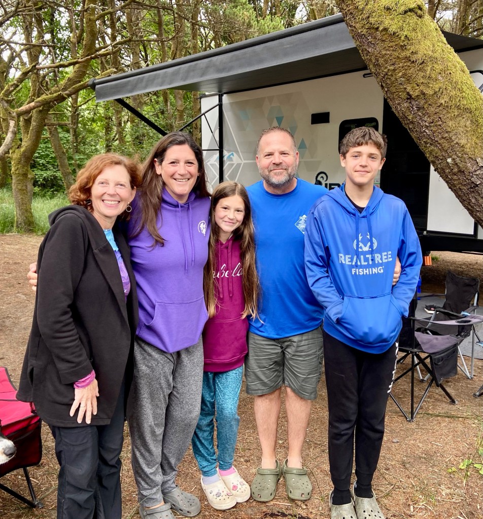
We drove about 2-1/2 hours to the coast of Washington and stopped at Ocean City State Campground to see my cousin Gary and his wife Angela and their kids Daxson and Mahala. They were camping one last time before starting the new school year.
We were excited to finally be seeing Olympic NP. It was established as a National Monument in 1909, and then as a National Park in 1938. It’s 922,561 acres and can be described as three parks in one, all centered around Mount Olympus. The park has 64 miles of ocean coastline, ancient forests, and snowy mountains. There is no road that cuts through the center of the park, so travel times are up to two hours from one section to another.
It is popular to take a car ferry across Puget Sound from Seattle to get to the park. Since we were meeting up with my cousin’s family, we did not do this, because it would have taken us to the Northeast part of the park. We were starting in the Southwest and working our way clockwise.
Continuing on up Hwy 101, we entered Olympic National Park. We stopped at the Kalaloch VC and picked up maps and stamped the passport.
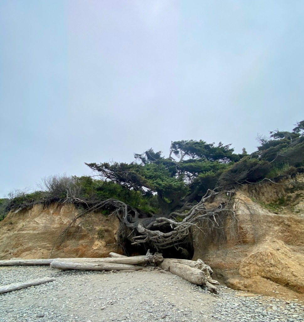
Continuing north, we stopped at Kalaloch and walked on the beach to see The Tree of Life, a tree on the beach where virtually all the soil has been washed away around the roots, yet the tree lives on.
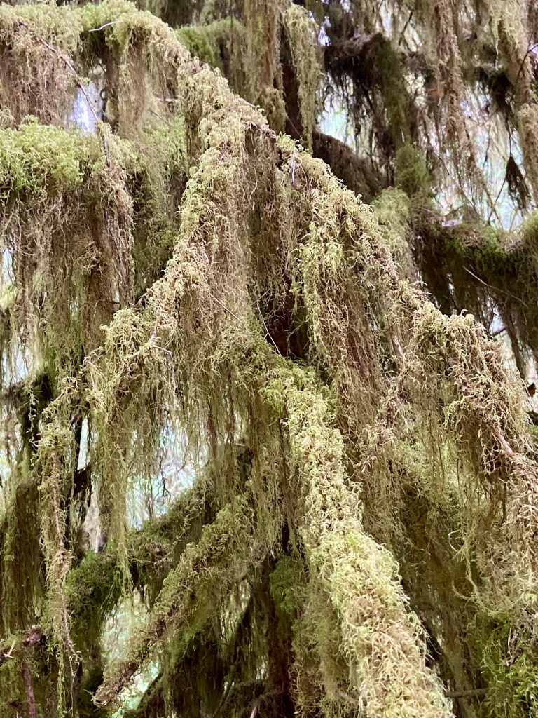
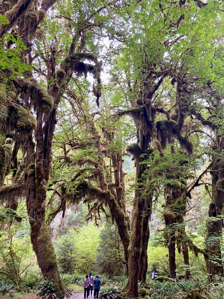
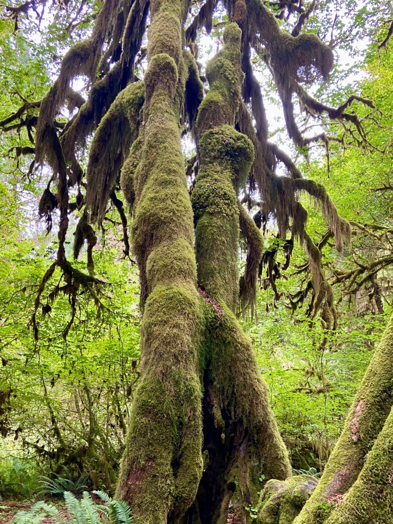
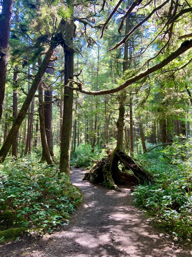
As we continued north on Hwy 101, we stopped at Hoh Rain Forest to walk The Trail of Mosses. As we entered the park, we took our picture with the official park sign. You have to enter the park here, and lit signs said there was a wait for parking. We were arriving after 4 PM though, so luckily the parking lot was clearing out enough that we only waited 2 minutes for a spot. The temperate rain forest was other worldly, so bright green, yet dark, with such lush vegetation. The walk is an easy .8 mile loop. There are Roosevelt elk in this area but we didn’t see any.
We drove through Forks, WA, the town the Twilight book series takes place in. The population of Forks is less than 3000 people. We needed some groceries. We stopped at the combo grocery and hardware store to shop. As you might expect, the prices were steep!
Tim also found a car wash with a bay high enough to give Calypso a much needed bath. With a refreshed food supply, and clean van, we finally arrived at Mora Campground on the west side of the park. It was a mossy fairyland. Nice campsite and very nice new bathrooms that actually had hot water! We had done a lot of driving, so we took a short stroll to the river bordering the campground. We were rewarded with seeing some otters playing in the river. We washed up and hit our pillows.
August 14, 2024
We slept in a little this morning. We are very close to the ocean, so the plan for the day was beach hikes.
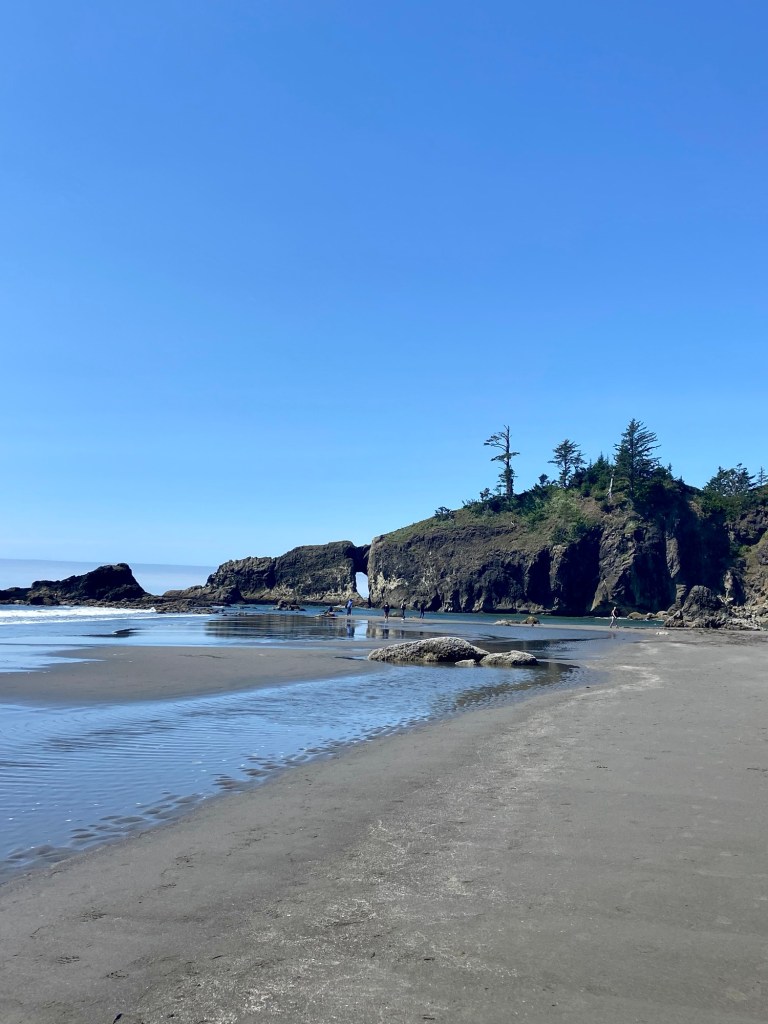
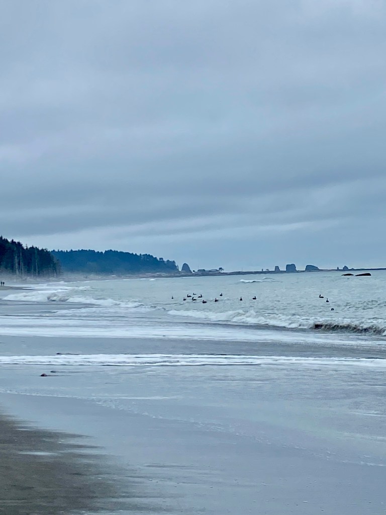
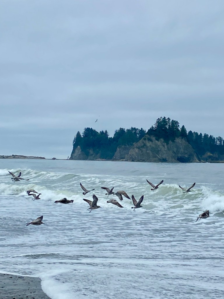
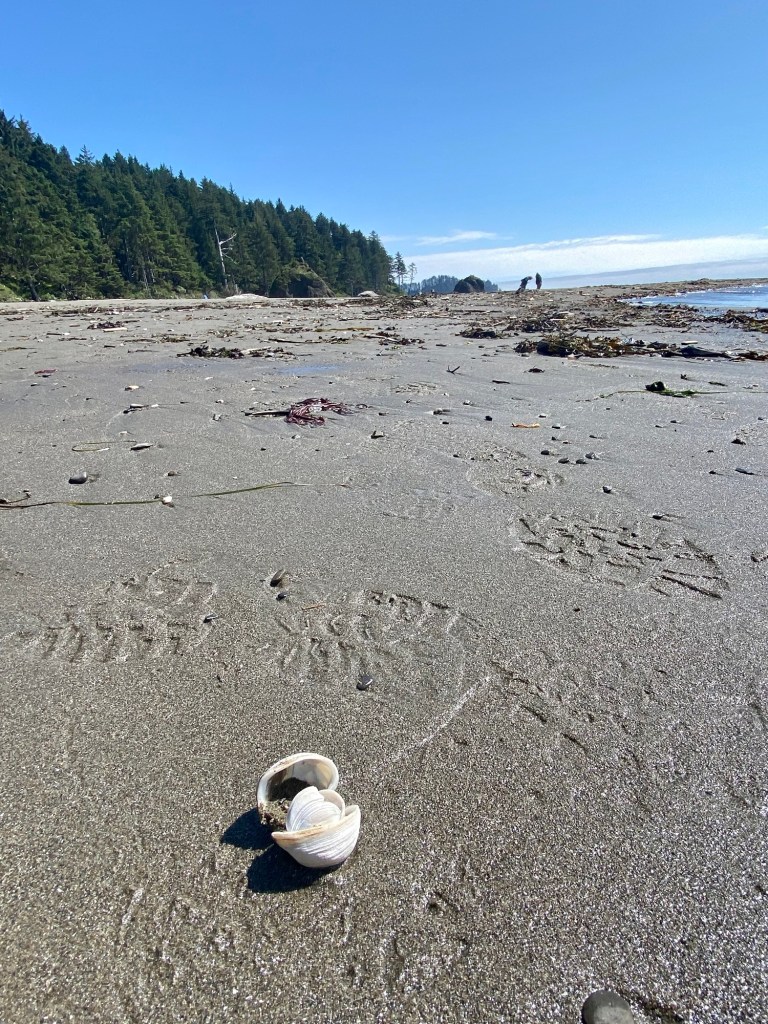
We began about 9 AM with Rialto Beach that is 1/4 mile from our campground. Low tide was at 4 AM, so the tidal pools weren’t very accessible. We did The Hole in the Wall hike, a 3 mile round trip hike on the beach. The beach is beautiful, with some great sea stacks. The beach is very pebbly. The tide was too high for us to walk to the “hole”. We had fun watching the pelicans and seagulls.
The 2nd low tide for the day was mid afternoon, so with a little time to kill, we drove into Forks and did laundry. We were hungry for pizza. Forks had two pizza restaurants. One had poor reviews. The other had great reviews, but was a take and bake place. I called and asked if they were able to bake it for us and they said “Yes.” Score! We devoured the pizza in their parking lot. Tim said it was the quietest meal we’ve ever had!
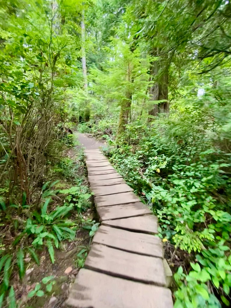
With full tummies, we drove to LaPush, which is part of The Quileute Indian Reservation, and found Second Beach for some tide pooling. Second Beach is really beautiful! We had to hike about 3/4 miles through a forest on a reservation to reach it. Parts of the trail were great, but there was one steep, wet, muddy section where I was very glad I didn’t wipe out.
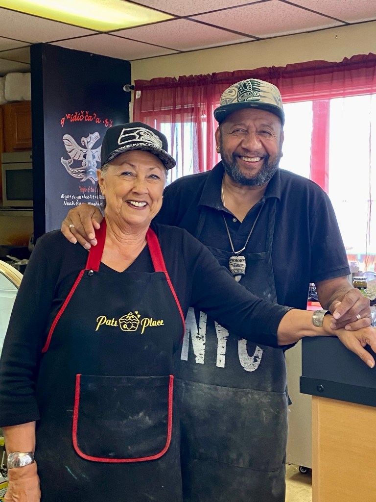
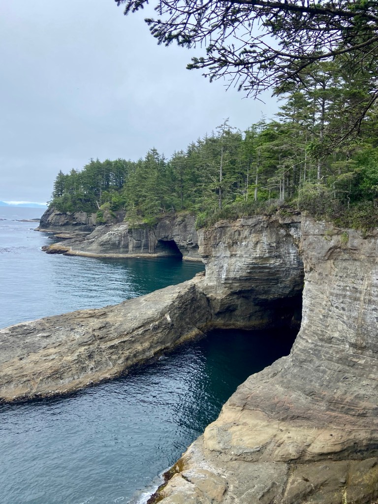
Our final beach of the day was Cape Flattery, which is on Makah Tribal land. You have to stop in the town of Neah Bay on your way to the reservation and pay for an annual pass. As we drove into Cape Flattery, there were signs on trees reading Pat’s Place – Pie! That was all Tim needed to see. We stopped at Pat’s and walked in at 4:50 PM. They close at 5:00 PM. They had one slice of chocolate cream pie. And…they were able to sell us the annual pass we needed for Cape Flattery! Pat and Julio were a hoot! It was obvious why it is a popular stop in town!
We drove to the trailhead and again had a 3/4 mile walk through the forest to the beach. This was more of a boardwalk to a point jutting into the ocean.
There were gorgeous sea caves, and sea stacks. People with binoculars saw whales far out in the bay. We saw a sea lion swimming. Tatoosh Island and it’s historic lighthouse are just off the coast. We did feel it was worth the effort to make it out there.
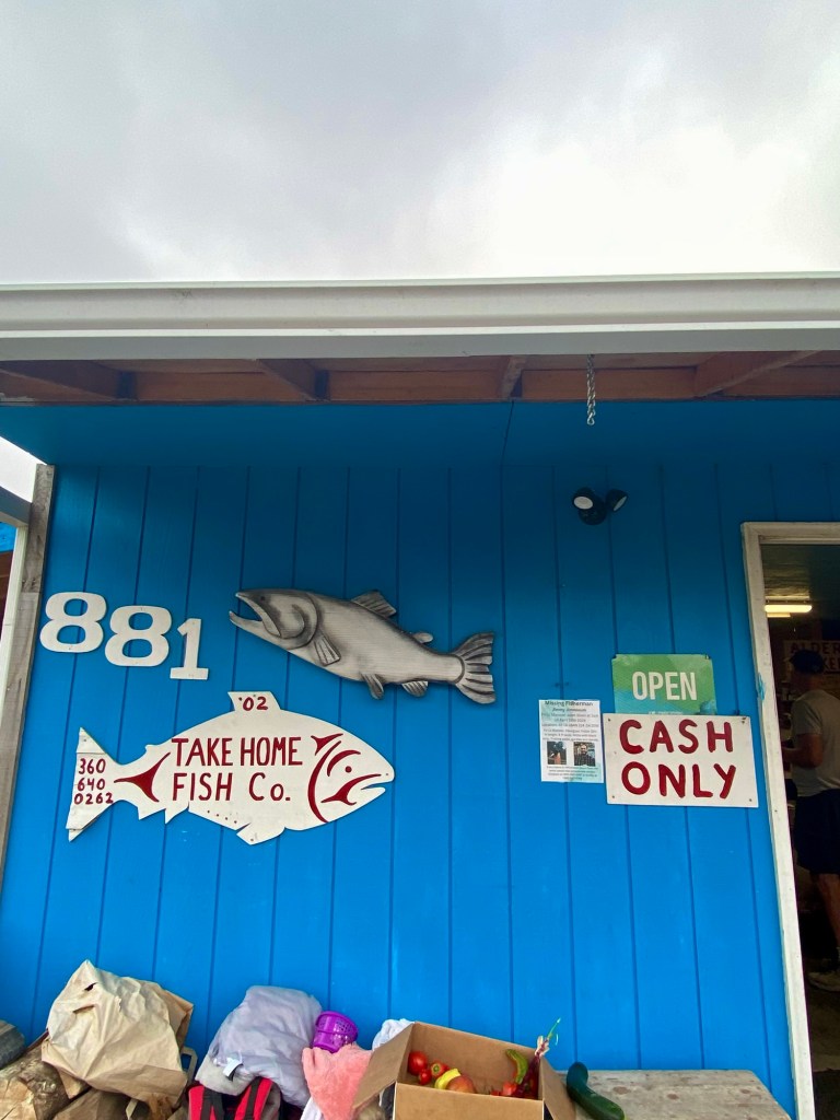
Tim asked whether there were any fish restaurants in Neah Bay. I looked on Yelp. The first thing I saw was Take Home Fish Company with all 5 star ratings. We drove there and met Kim, who has been smoking salmon out of his garage for 40 years. We sampled some and it was wonderful! We look forward to enjoying the package we bought from him.
We stopped at the Neah Bay Marina and ate the chocolate cream pie and headed to The Lake Crescent area of Olympic to find Fairholme Campground, our home for the night.
August 15, 2024
What a day! It was partly sunny when we woke up.
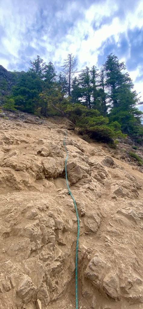
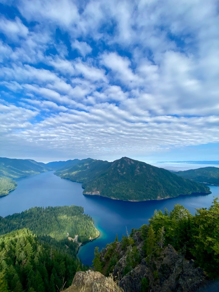
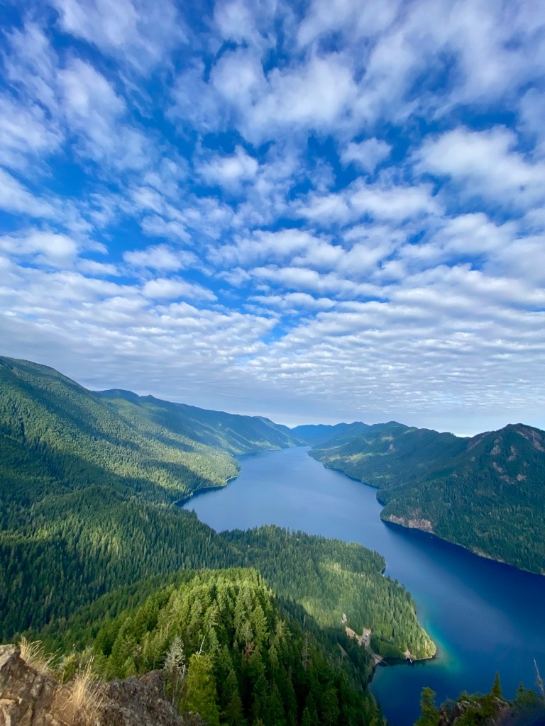
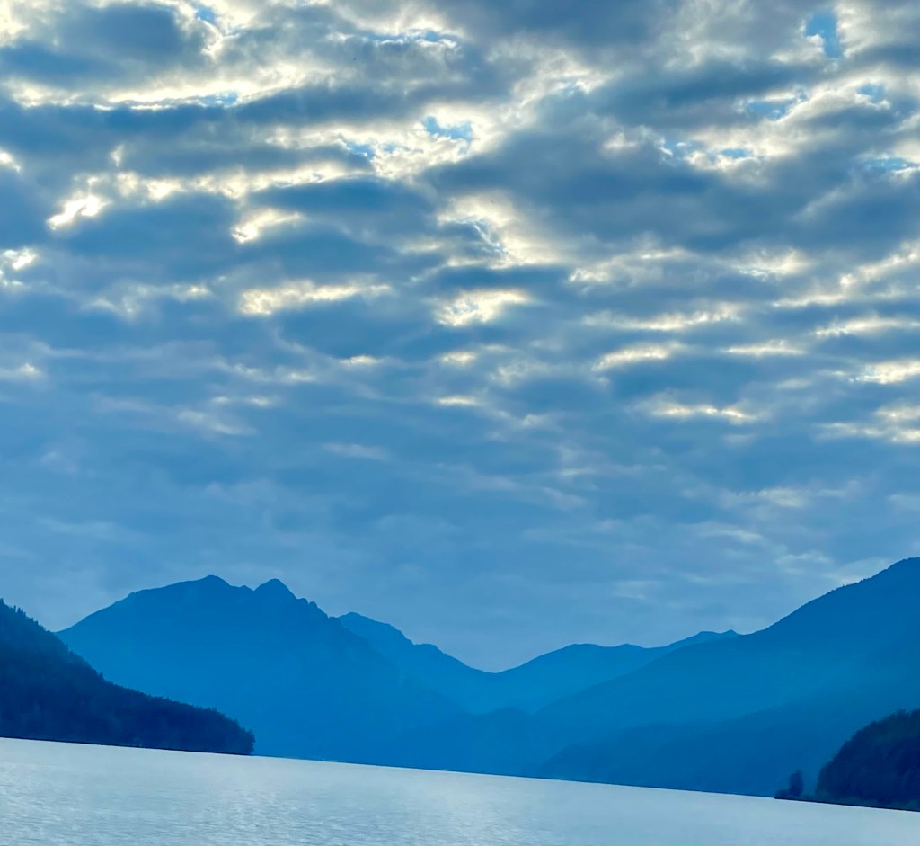
We saw Lake Crescent for the first time on our drive to Storm King Ranger Station. The lake is huge and a beautiful green blue. We would see more of the lake from our morning hike of Mt. Storm King. The hike was 4.4 miles round trip and was straight up the entire way with 2200 feet of elevation gain in 2.2 miles. We hiked through gigantic old growth forest. The trail had many, many tree roots to go over and around. We met two young ladies on the way up. One had a serious looking brace on her leg and she wasn’t sure she was going to make it to the top. After 2 miles the “official” trail ends and you have to use ropes to climb the steep scree slope to the summit. I was really nervous about the ropes, but they weren’t too bad! There is a pile of gloves People have left behind, so if you didn’t bring any, you can borrow a pair. Once the ropes ended there was still a short ascent to a steep rocky outcrop to reach the summit. All Trails took us a bit off the route there. We ended up scrambling up a steep slope that was much more dangerous than the trail. Yikes!
Once we reached the summit, we were treated to beautiful views of the lake! We ate a snack with a bunch of lovely people. The birds and chipmunks at the summit are obviously used to people feeding them. They would land on your hand if you put it out. One landed on my head and gave me a two second scalp massage! The two women we talked with on the way up made it all the way.
Normally we descend a climb much more quickly than we ascend. Not today. The footing was so tricky and so steep, it was about the same as going up. We were filthy by the time we finished. The ropes were really dusty and we may or may not have crab walked down some of the steeper parts! Mount Storm King was an epic hike! I’m so happy we did it.
Once down, we continued on to Marymere Falls 1.8 miles round trip to a waterfall. That was our cool down hike. Back in the parking lot, we ran into the young women one more time. They rented a jeep with a roof top tent from a company in Seattle. It was a very cool set up! We ate lunch there in the parking lot.
After lunch, we drove about 30 minutes to Port Angeles, where Olympic NP’s headquarters are. We watched the excellent park movie, called Mosaic of Diversity.
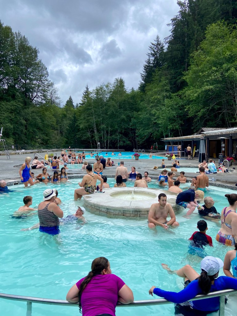
It had been a while since we had had a real shower. There aren’t any public showers in the campgrounds or in the towns we were near. There are hot springs in The Sol Duc region of the park. We drove there to see if there were any day passes available. We were in luck! We got to enjoy four hot springs of different temperatures for an hour and a great hot shower at the end!
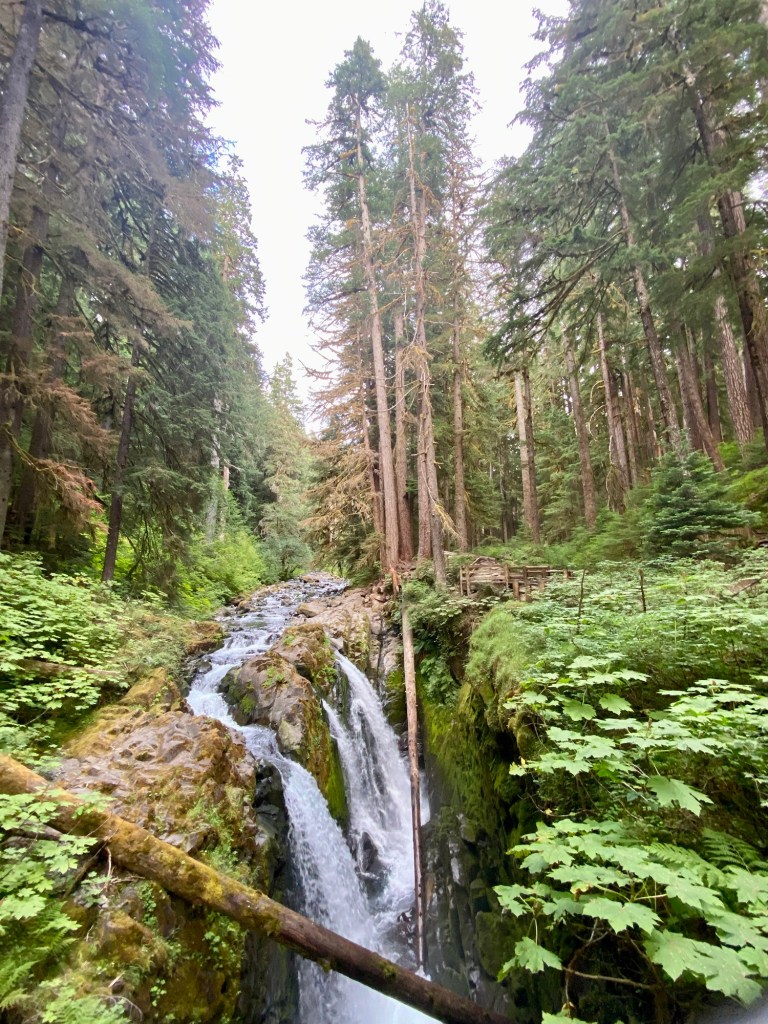
It worked out great that our campsite for the night was nearby. We had dinner and drove a few miles for a 1.6 mile easy stroll to Sol Duc Falls, a gorgeous set of 3 channels of waterfalls. Back at the campsite, we charged the Jackery and washed dishes and called it a day!
August 16, 2024
We began the day with stopping near our campground to see the salmon spawning exhibit. Chinook and Coho salmon have been spawning in these rivers for millennia. The salmon leap up the river cascades returning to the same quiet pool they were born in. After the females lay their eggs and the males fertilize them, the exhausted salmon die , but their carcasses give life to other forest creatures. The Sol Duc River is one of the few places where salmon run in every season. We did not see any fish, but the water was crystal clear! I wish my dad was here to see this! He’s a wonderful salmon fisherman.
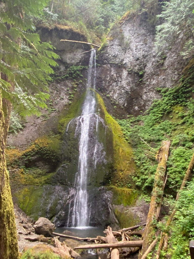
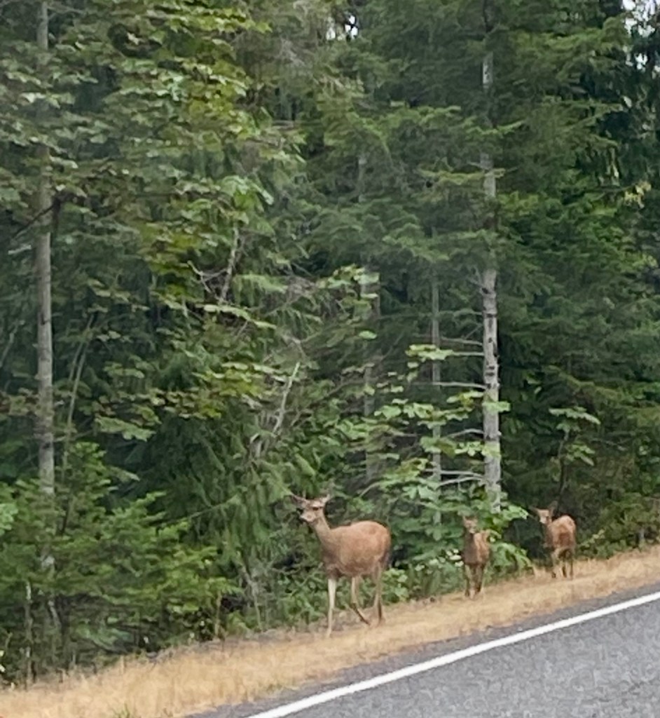
We continued on to Madison Falls, a .25 mile paved path to wonderful falls. We saw a doe and her twin fawns on our way back to the main road.
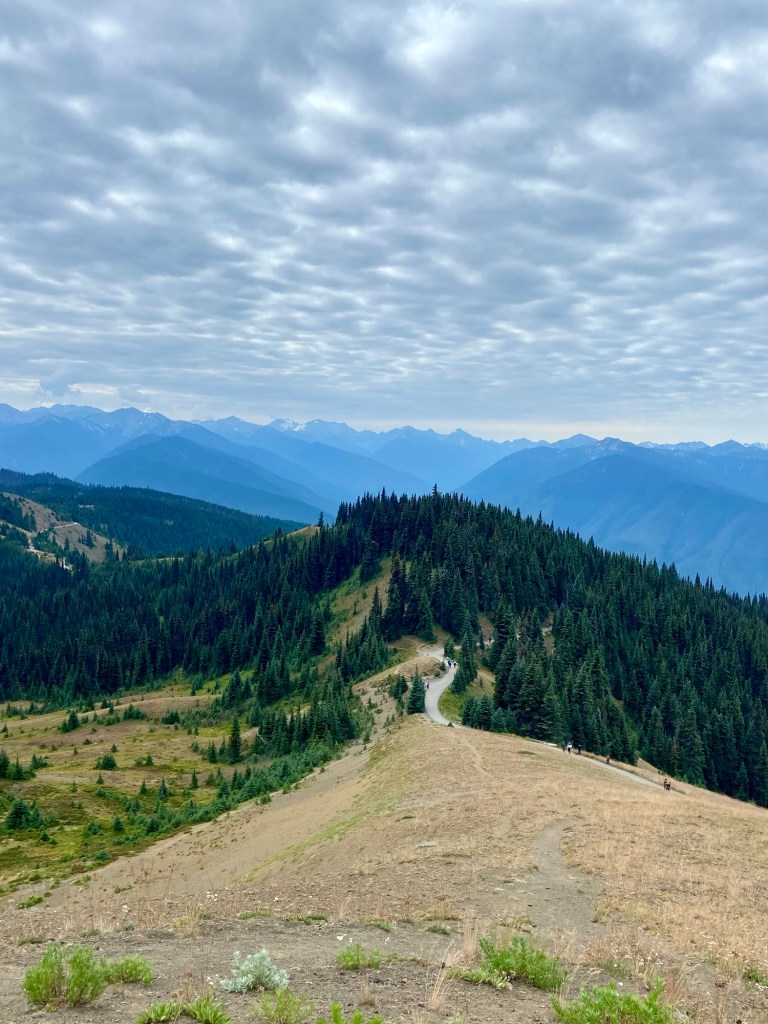
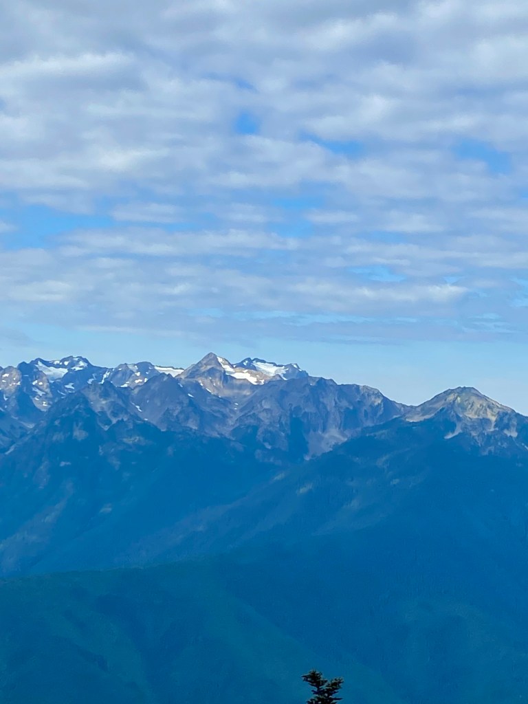
Our last stop in Olympic NP was Hurricane Hill, a 3.2 mile hike with 700’ of elevation gain to stunning views of Mt. Olympus 7980’ that the park was named for. This was the first time we actually saw the mountain! This was one of the hardest easy hikes we have done and it was paved! Stunning views of the mountains, the Strait of Juan de Fuca (which connects Puget Sound to the Pacific Ocean), and we saw marmot, and black tailed deer.
In three days we saw an unbelievable amount of beauty. This is a huge very special park with so much to see and do. It seems like we say that about each park, but really, we only scratched the surface of Olympic National Park!

Leave a reply to philosopherdeliciouslyb4ff502a85 Cancel reply