
Sunday, March 3
If you’re paying attention, when we left Yosemite we were heading to Sequoia and Kings Canyon next.
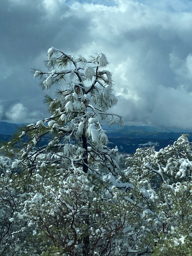
We hung out in Fresno for 2 days waiting for the blizzard in The Sierra Nevada Mountains to abate. The NPS phone line to check roads and weather never said the park was closed and on Saturday the recorded message said chains were required, but Sunday AM, it didn’t say chains were required. So, we drove up to Kings Canyon. Much of the way up, the pavement was dry and there was no snow on the ground. Gradually though, there was some snow on the sides of the road, but the road was still bare.
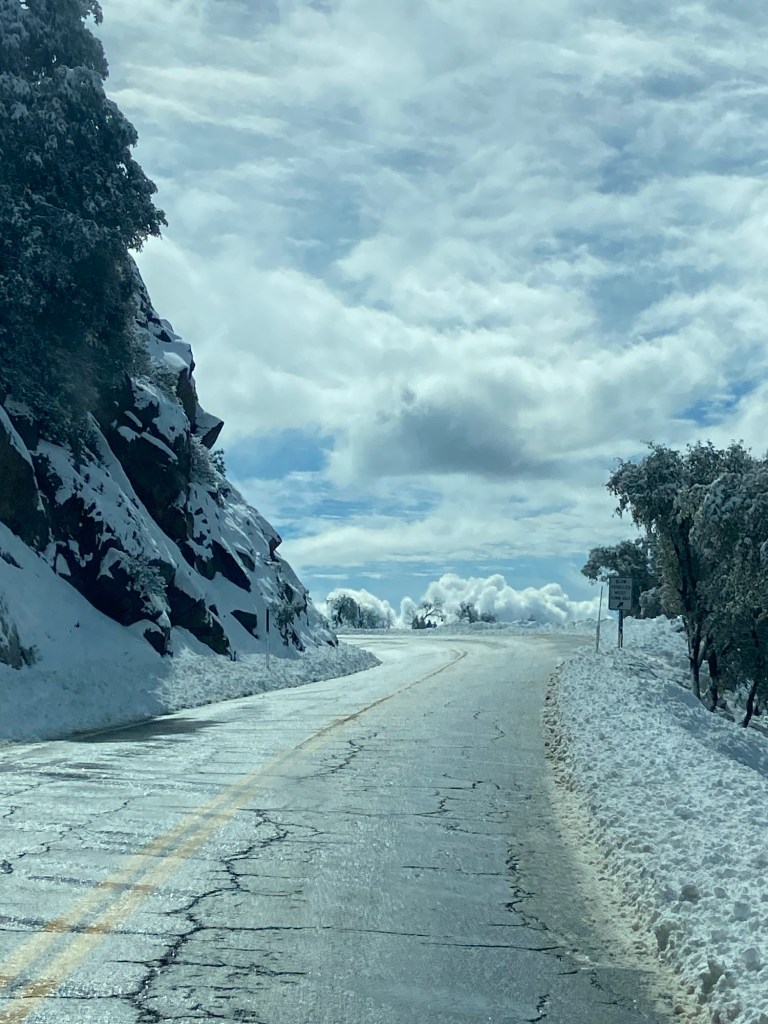
We made it all the way to the entrance, and the ranger said we had to put the chains on or we couldn’t come in. Also, the campground was closed and unplowed. She couldn’t tell us when the chain restriction would be lifted or the campground would be open so, we didn’t have much choice but to turn around and leave back down the mountain. We debated going back to Fresno, but neither one of us really wanted to spend a few more days in Fresno, so we headed for Death Valley.
Death Valley…desolate, and daunting and very beautiful.
Death Valley is the hottest place on Earth and the lowest elevation in North America. It is also the largest National Park in the lower 48 states with 3.4 million acres. Fortunately, this time of year the temperature is a wonderful average of low 70s.
It was a long drive 6 hour drive through a lot of deserted desert country to Death Valley. We stopped at the entrance sign at the same time a young man did. So we took his photo and he did the same for us. We arrived around 5:30 PM and since I had been unable to secure a same day reservation in the Furnace Creek campground – the only one that accepts reservations in the winter, we stopped at Stovepipe Wells Village. The Village had a gas station, a saloon, a small hotel and a first come, first serve campground.
There were many open spots in the campground. We selected our spot for the night. We had several nice conversations with neighbors. There were people checking in for a 5 day charity bike ride through different parts of the park. Last year, the same group rode through Glacier NP. Another neighbor asked to see our van. She and her husband and a few other couples had driven up from Southern California with kayaks. Why did they need kayaks at Death Valley? I’ll get to that in a minute.
The star gazing at a Death Valley was supposed to be quite good. But the sky was pretty hazy that night.
Monday, March 4
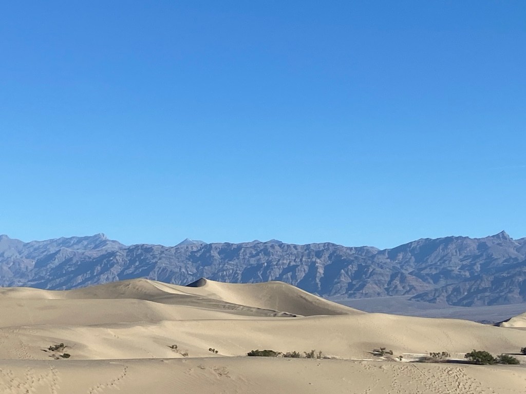
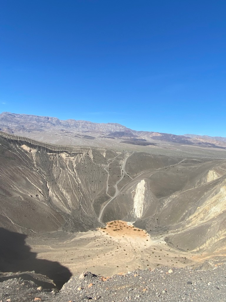
We got up and headed to our first destination in the park, Mesquite Flat Sand Dunes. We explored the dunes for a bit. Next we drove about an hour to the remote NW section of the park to hike at The Ubehebe Crater. There were long stretches where there appeared to not be a single thing growing. They believe about 300 years ago, molten lava and ground water combined which caused a huge explosion resulting in a 600 foot deep crater. The hike around the rim is 1.5 miles. There were a few flowers growing along the rim of the crater.
After that hike, we drove to the Furnace Creek Village part of the park. We got our passport stamp, watched the NPS movie about the park and got some advice on hikes from a Ranger.
We ate a quick lunch in the van and headed towards the south part of the park intending to check out the Badwater Basin area and a slot canyon hike.
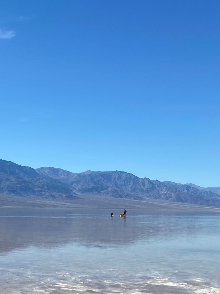
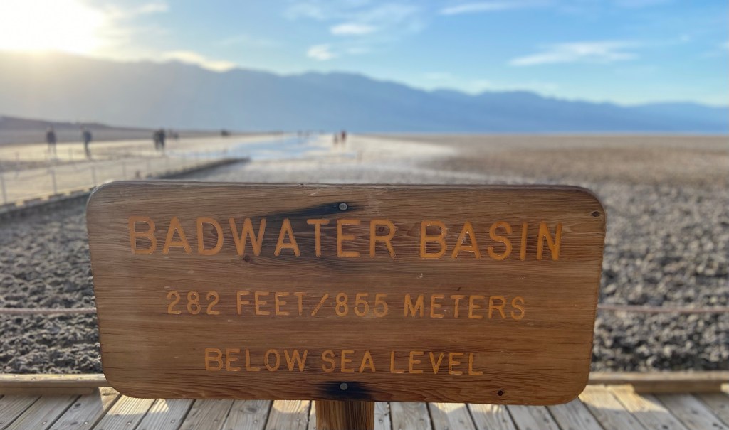
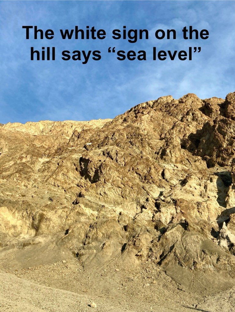
We reached the Badwater Basin area. It was a mad house because of a relatively rare occurrence going on right now. Badwater Basin is generally an area of huge salt flats. It is the lowest elevation in North America at -282 feet. Back to the reason some people had come here for kayaking. They recently had heavy rains and it temporarily turned the salt flats into a lake, called Lake Manly. People were wading into it, as well as kayaking and paddle boarding.

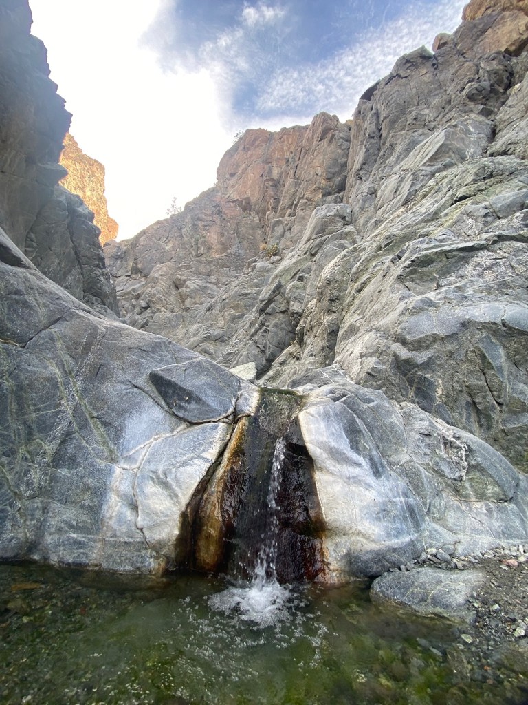
We walked around on the shore for a bit and continued south to the trailhead of Willow Canyon. It was a 4.5 mile round trip moderate hike mostly in a wash that lead to a canyon and a small waterfall at the end of the canyon. It was pretty, but after the waterfalls off Yosemite, it was a little underwhelming. But, I’m pretty sure that any waterfall in Death Valley is a big deal.
We headed back towards Furnace Creek and our campsite. We made a pit stop at The Devil’s Golf Course to watch the sun set behind The Panamint Mountains on the western side of the park and we drove the Artist’s Palette Scenic Drive just as it got dark. It reminded both of us of The Badlands.

We had a quick campfire and went to bed.
Tuesday, March 5
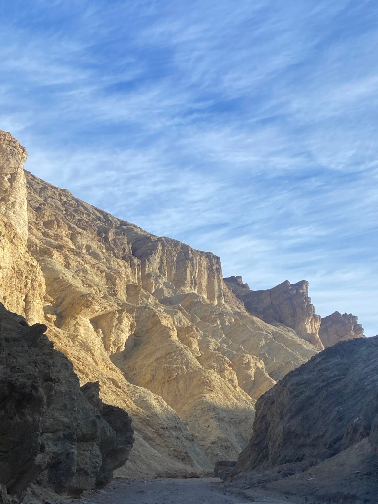
Up and out fairly early, we started the day with the 5.5 mile moderate Golden Canyon/ Gower Gulch Loop with the Red Cathedral spur. It was our favorite trail of Death Valley so far. We started in a canyon with beautiful golden walls and then gained some elevation on the side trail to Red Cathedral. Then the second half, Gower Gulch had some very steep sections before finishing with a little rock scrambling. A great start to the day!

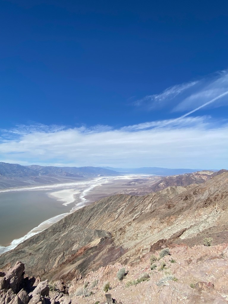
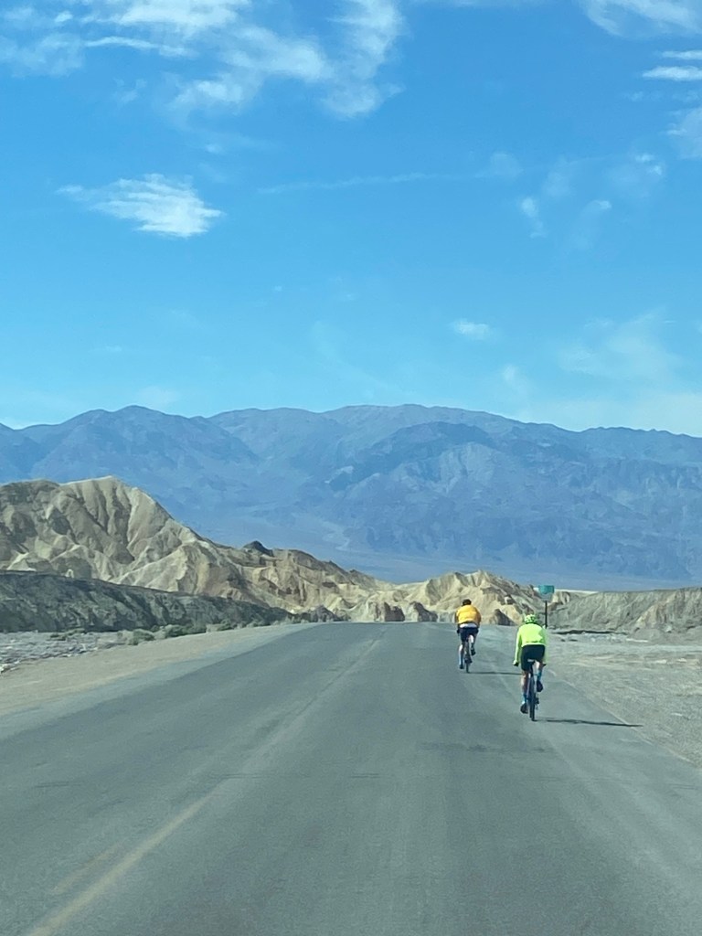
Next we drove about 30 miles to a viewpoint called Dante’s View. We ascended from below sea level to 5475 feet above Death Valley. We passed quite a few cyclists on the road to the summit. Tim was quite impressed that they were cycling such a challenging route. The last quarter mile of road was a 15% grade! The scenery was breath taking! We ate lunch from this beautiful view point.
We drove back to Furnace Creek and visited the Harmony Borax Works. Borax was one of the most profitable things of the many things people tried to mine in Death Valley. The last borax mine in the park closed in 2004.
We made a few stops in the village, most importantly for ice cream, and next for showers. Unfortunately, the showers were closed for maintenance. We warmed up some water at our campsite and sponge bathed.
Wednesday, March 6
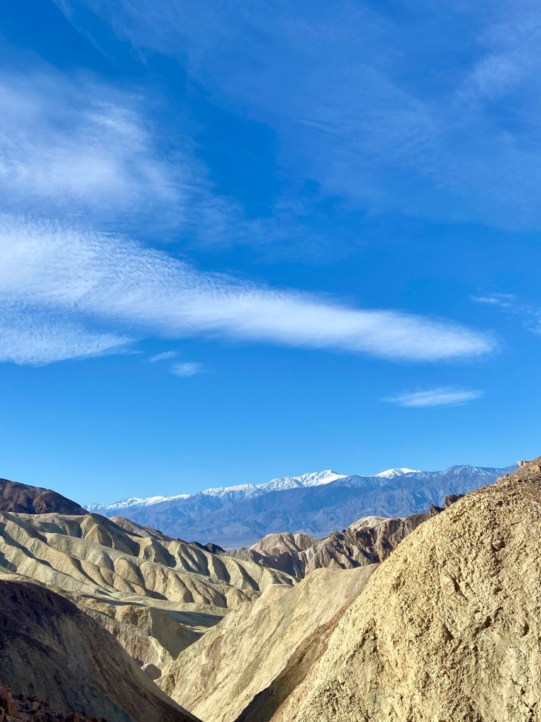
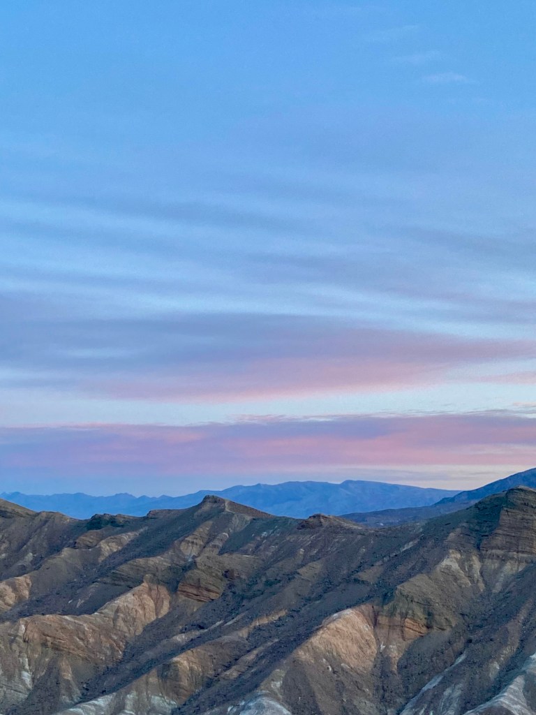
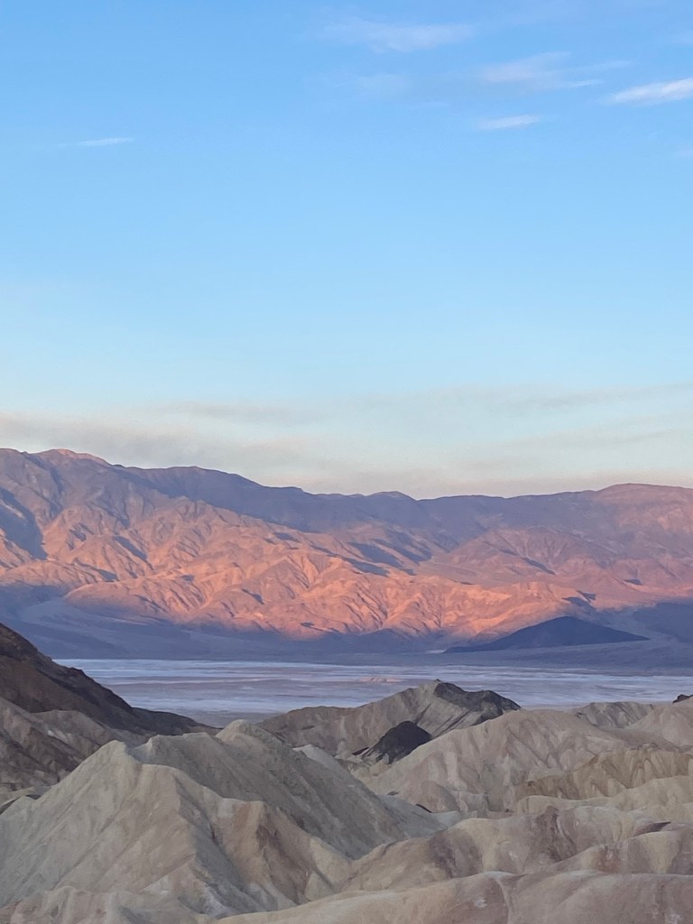
We got up very early and drove to Zabriskie Point for sunrise. It is a popular view point. There were at least 75 of us there for sunrise. The rising sun lit up the beautiful colored rocks.
We continued down the road en route to The Grand Canyon!

Leave a reply to dontidrick Cancel reply