July 30, 2024
We left Grand Teton around noon and drove 8 hours toward Sacramento, CA and slept in possibly the most basic rest stop we have experienced. It was a parking lot with filthy pit toilets and no running water. But, on the bright side, we both slept pretty well. And that was all we needed.
July 31, 2024
We woke up, brushed our teeth and continued toward Sacramento. Tim takes auto maintenance very seriously, and Calypso needed an oil change.
We arrived about noon and ate lunch and watched The Olympics in the dealership waiting room.
We left the dealership about 2:45 and drove to Fresno to stay at the RV Park we stayed at back in March when we last attempted to visit Sequoia and King’s Canyon. We had wonderful hot showers. It was 102 degrees in Fresno today! We ate dinner at a mom and pop Thai restaurant called Thai Me Up! Lol! The food was delicious.
August 1, 2024
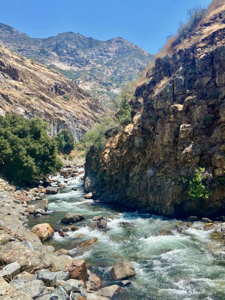
We set out this morning to grocery shop and then head to King’s Canyon. We enjoyed the drive much more today than when we tried to get into the park after a blizzard this past March. We sailed up to 6000 feet and entered the park.
King’s Canyon and Sequoia National Parks are operated as one unit by the park district. Sequoia was the 2nd National Park established and King’s Canyon was the 3rd.
John Muir was pretty instrumental in getting the land declared a National Park. Today there is a 211 mile long John Muir trail connecting King’s Canyon and Yosemite National Parks. The parks are located in the Sierra Nevada Mountains. Mount Whitney, the highest peak in the lower 48 states is located within Sequoia, but is not visible from any road in the park. (No, we didn’t climb it.)
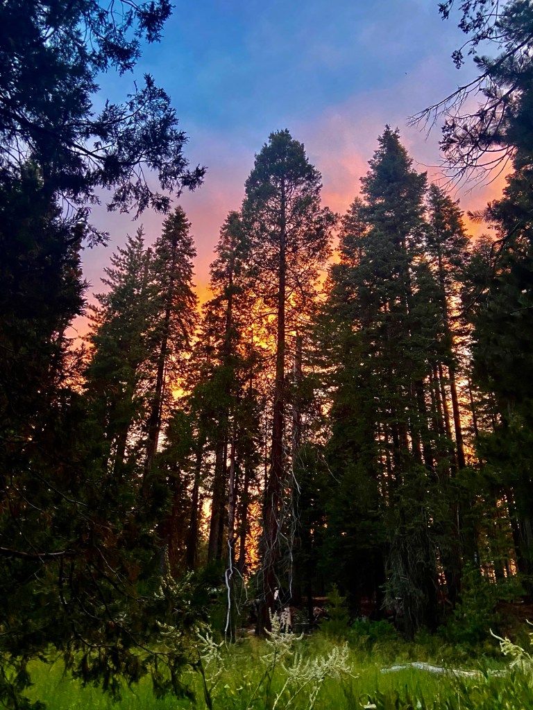
Our first stop was the General Grant Grove. Seeing the sequoias up close was really special! Almost like a religious experience! We spent some time hiking the trails around the General Grant Grove and visited the visitor center, but we didn’t have the National Parks passport on us. We watched the park movie and headed back to Calypso.
Back about 6 years ago when we hatched our plan to visit all the National Parks, Tim and I read a series of books called Dear Bob and Sue, which are written by Matt and Karen Smith, about all their explorations of the US National Parks. They also do a podcast, and we typically listen to the episode for the park we are on our way to the day before we arrive.
We listened to Karen and Matt’s episode for Sequoia and King’s Canyon as we drove from Reno to Sacramento. They rhapsodized about a part of King’s Canyon that is very remote, and they said it reminded them of Yosemite Valley (without Half Dome). They talked about how twisty and dangerous the drive was, and how people have died driving off the road in that part of the park. We kind of figured that part of the park was going to be out for us. But, while we were talking to the Ranger at the VC, I asked her about how treacherous it was. Surprisingly, she said, “The road is great! We just replaced a big section of it.” I said “Even for a 22’ van?” And she said “You should be fine!” This opened up many new options. So we took that twisty, treacherous King’s Canyon Scenic Byway out to the point where the road ends at The Road End Permit Station. We were fine! We have been through much worse roads.
We had lunch at Muir Rock in some lovely shade with a breeze. It was 91 degrees at 12:30 PM today.
We continued with a .8 mile hike to Zumwalt Meadow. I took off my socks and shoes and waded in the refreshing stream we crossed.
Next we did the .3 mile hike to Roaring River Falls. There were some people swimming even though there were signs posted all over that it is dangerous to swim in these streams because they are flowing so fast.
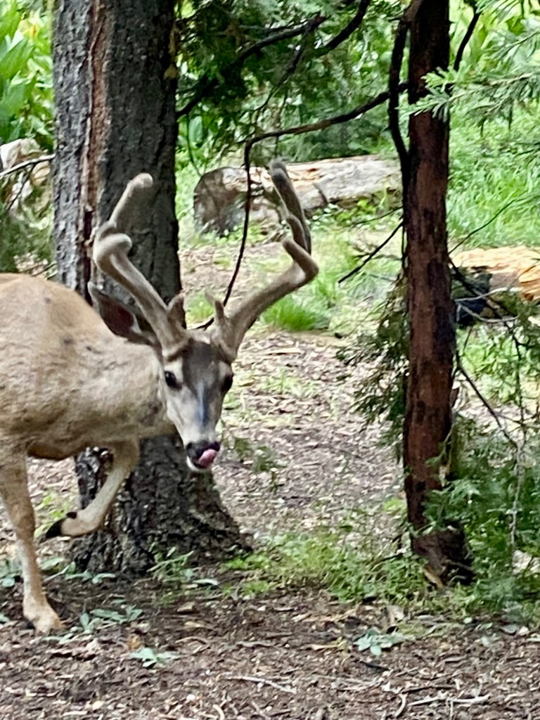
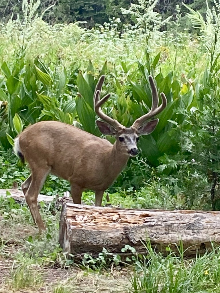
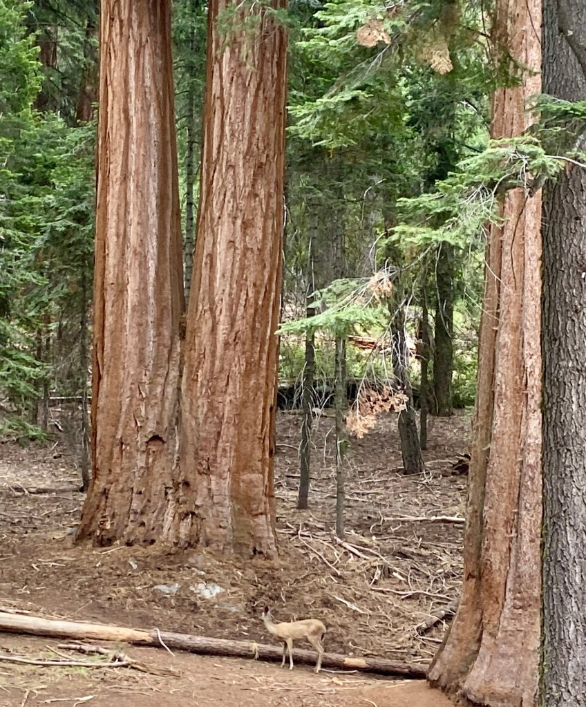
We found our campsite in Crystal Springs Campground. It was very secluded, which was great, but it was also about 1/4 mile from a bathroom, which is the furthest away we have ever been. We ate dinner and were able to have a toasty campfire. A pair of buck Mule Deer joined us for at least 30 minutes taking advantage of the tasty plants in the meadow behind us.
August 2, 2024
Some crows cawing woke us up. We got ready and set out for Sequoia NP along the General Sherman Highway. We were pretty much alone at this time of day.
We stopped at The Sequoia National Park sign and a nice family took our picture. Then we stopped at The Lodgepole VC to see what we wanted to do.
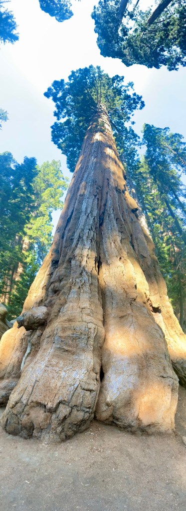
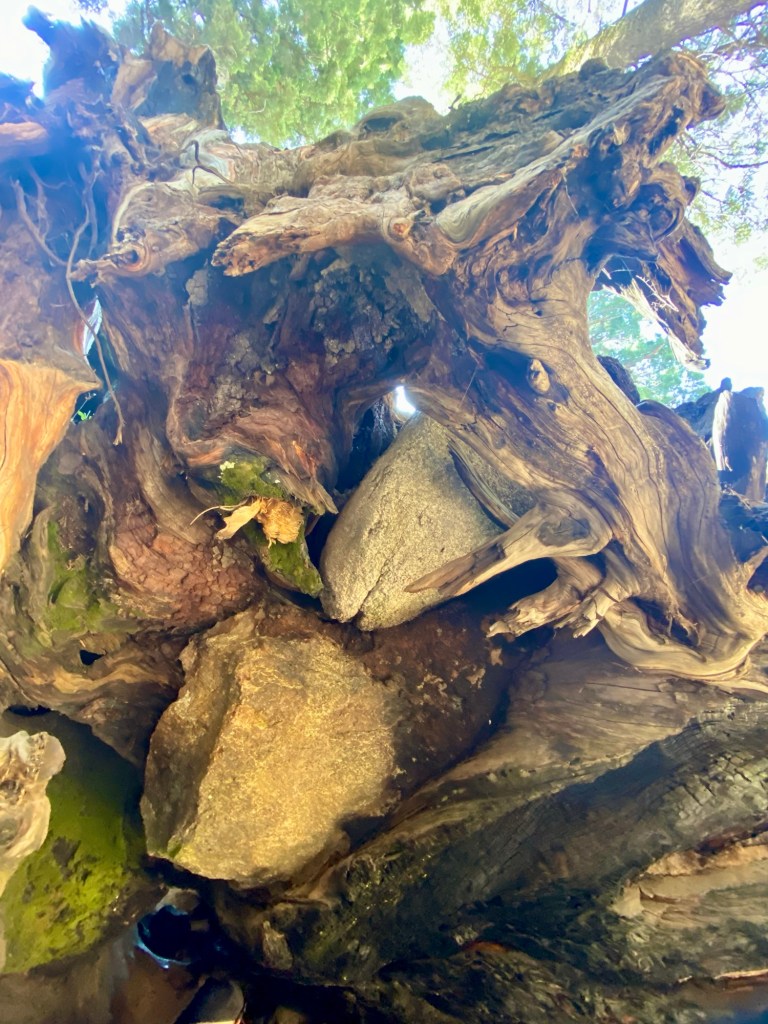
We read that every single sequoia in the park has been touched by forest fire and I was feeling sad about that. Then we learned that to an extent, forest fires are beneficial to sequoias.
A cycle of low to moderate fires help make room for seedlings to take root, and grow tall.
How do the trees survive intense forest fires? Three things:
-Their bark is up to two feet thick
-Their sapwood doesn’t burn easily, so they don’t explode. It is watery and not very flammable.
-Their heartwood contains tannins, so it doesn’t rot easily.
However 20% of all ancient sequoias have been destroyed by fire in just the last 4 years!
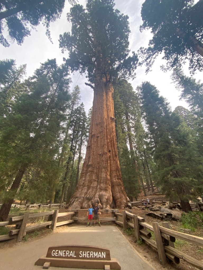
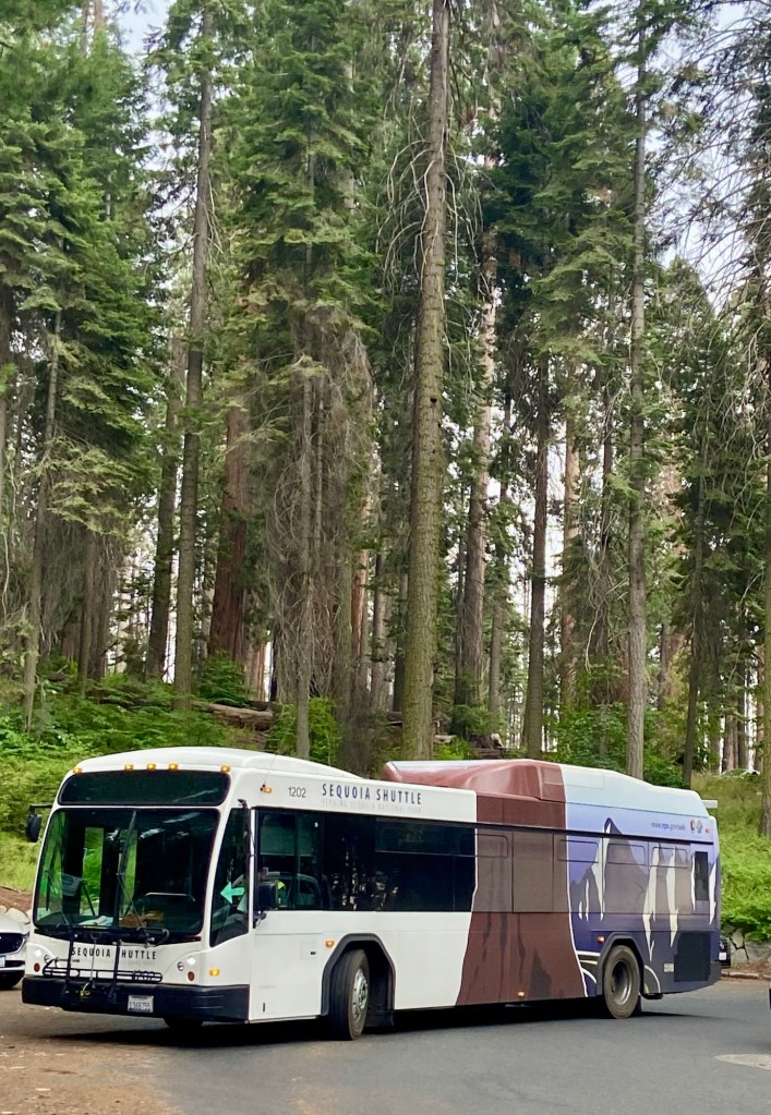
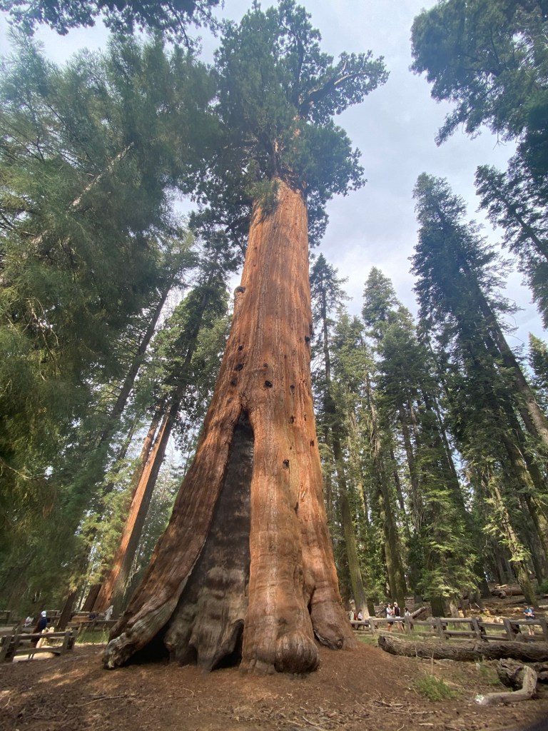
We left Calypso at The Lodgepole VC and used the shuttle bus service to get to The General Sherman Tree, which is the largest tree by volume in the world!
Giant Sequoia roots are usually no more than six feet deep. But the roots spread wide and often intertwine with surrounding trees which help all of them stay upright.
We hiked the 2.9 mile Congress Loop through the sequoias. There are also groups of sequoias named The House, and The Senate, etc. It was a beautiful hike.
Still, it was sad to see the bases of most of the trees all hollowed out from fire scars. It is incredible that they live through it!
Tim often wears t shirts from different colleges he has visited. He looks at what other people are wearing and strikes up conversations. So we were on a trail with a man wearing a t shirt with Trinidad across the front. Tim asks the man “How is Trinidad doing in the Olympics? The guy gave Tim such a funny look, and they both laughed.
We got back on the shuttle and got off at The Giant Forest Museum. We did the 1.2 mile Big Trees Loop there. It was interesting to learn that they used to have a store and cottages around these trees until it was discovered that it was damaging the shallow root system the trees have.
Next we shuttled south to Moro Rock, a huge boulder with stairs built around it and am incredible 360 degree view from the top. The hike is .5 miles and 350 steps straight up. The views were worth the climb. On our way down the stairs, we ran into “Trinidad man” again, and without Tim saying a word, the man said “Trinidad is struggling, but Tobago is doing pretty well!” LOL.

After that, we caught the shuttle to return to the VC. As we waited for the shuttle, it began to mist. We just got everything in before it began to thunder and lightning and rain. We would not have wanted to be on Moro Rock while it was lightening!
Now that we were basically done with the park, we watched a film about black bears in the park and got directions from the Ranger on the most direct route to Redwoods NP and we got back on the road.
We are so happy that we got to experience these two parks in better weather! They are gems!

Leave a comment